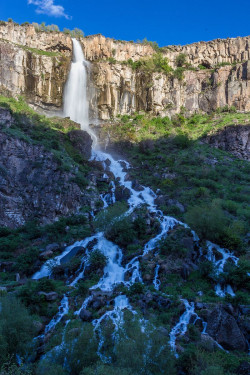
Aragatsotn Province
Literally meaning "the foot of Aragats" (the highest mountain of the Republic of Armenia), it is named after the Aragatsotn canton of the historic Ayrarat province of Ancient Armenia, ruled by the Amatuni noble family under the reign of the Arsacid Dynasty.Aragatsotn Province occupies the northwestern part of Armenia and covers an area of 2,756 km² (9.3% of the total area of Armenia). It has internal borders with Shirak Province from the north, Lori Province from the northeast, Kotayk Province from the east, Armavir Province from the south and the city of Yerevan from the southwest. The Akhurian River at the west separates Aragatsotn from the Kars Province of Turkey.Historically, the current territory of the province mainly occupies parts the Aragatsotn, Nig and Shirak cantons of Ayrarat province of Ancient Armenia.The northern part of the province is dominated by the Aragats mountain range. At the northeast and the east, it approximates the mountains of Pambak and Tsaghkunyats respectively. The mountains of Arteni dominate the northeastern and the central eastern parts of the province. The tiny Akhurian valley occupies the eastern edge of Aragatsotn. In the south and the southeast, Aragatsotn occupies the northwestern parts of the Ararat plain.The altitude of the province ranges between 950 and 4,090 meters above sea level.Mount Aragats (4,090 m.) is the highest peak of Aragatsotn and the Republic of Armenia.Besides the Akhurian river, the rivers of Kasagh, Gegharot and Amberd are the main water resources in the province. Mountainous lakes including Lake Kari, Lessing, Amberd, Tagavor and Kuraghbyur are found on Mount Aragats. Between 1962 and 1967, the Aparan reservoir was built on the Kasagh river.The climate of Aragatsotn is deeply diversified due to the wide range of altitudes of the region. The annual precipitation level ranges between 400 mm (16 in) at the lower areas and 1,000 mm (39 in) at the mountainous territories.

